Up Gunung Nuang
Some says, before you can conquer Malaysia’s highest peak, you can test out your capabilities at Gunung Nuang. Gunung Nuang or Mount Nuang is very famous for Malaysian trekkers looking to train prior to a climb up Gunung Tahan or Gunung Kinabalu. Even the Fire & Rescue Department of Malaysia (BOMBA) trains there!
The mount is located in Pangsoon, about 24 miles from Hulu Langat. There are food stalls along the way, so for those of you who (somehow) did not pack any food with you, you can stop by any of the stalls to grab a packet of nasi lemak (rice cooked in coconut milk and accompanied by sambal, which is chili paste cooked with onions and/or anchovies, a slice of hard-boiled egg, cucumber slices, fried anchovies, and peanuts).
Gunung Nuang is the highest mountain in the state of Selangor. Peaking at a height of 1493 meters, you can probably reach the summit within 8 to 9 hours – all at a comfortable pace. On a good day, the climb is not very strenuous, but after a heavy downpour, it can turn rather challenging where you may encounter fallen tree branches and muddy laterite that makes the hiking tougher. However, for the veterans, it would seem more like walking up a staircase continuously for hours. Because the hike is within a day, you can choose not to spend the night there. But it is common to see people hiking up with all their camping gears for an overnight adventure at the Pacat campsite.
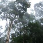
However, because this mountain is the “training ground” for climbers aspiring for more, do not expect to see pristine nature. The view at the summit is pretty decent although not breathtakingly wow because it is surrounded by a lot of trees. But on a good day, you can see Genting Highlands and Kuala Lumpur from there. Also, the trek is rather eroded and the campsite is quite an eyesore with rubbish strewn all over. However, on the plus side, on a lovely clear day, you can see a lot of butterflies there.
First thing first, you need to register yourself at the ranger’s office before you can embark on this hike. It cost RM1 per person. If you want to hire a guide, it will cost you RM25 per head. The guide will lead you to the Lolo campsite. Before you go, make sure you have all your gear and necessity items such as warm clothing, tent, stove, food, water, light, and so forth; all these if you intend to stay the night. Otherwise, just bring water, good shoes, and extra clothing. After the registration process, you are ready to go.
There are three hiking routes that lead to the peak. The two that starts from the state of Selangor side is at Kuala Pangsoon in Hulu Langat and Kampung Kemensah in Gombak. The third path is from Bentong in the state of Pahang, which starts from Bukit Tinggi. These routes were built by the Malaysian Department of Wildlife and National Parks.
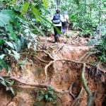
The easiest part of the whole climb is definitely the starting point. The start of the trail is wide and very easy to walk. With each step, the trail gets harder. Here, the trees and scrubs get thicker and denser, and the trail is narrower. It gets rather tough when you are about to reach the Lolo campsite. Also, as mentioned earlier, the trail tends to get rather muddy and slushy after a downpour, so you may want to watch where you put your foot down. When it rains, the middle part of the trail is so muddy that you can actually feel your feet sinking into the mud and making contact with sharp stones. So, while it is easier to slip and slide around without your shoes on, it is far more dangerous not to have them on. Also, be on the lookout for leeches. These creatures are out to feast! For most parts though, the trail is surrounded by thick jungle; and on the way to the Lolo campsite, you will also need to cross several streams. Do be careful here and watch your steps, because you will be required to step on rocks to get across. If you are not careful, you may just slip and hurt yourself.
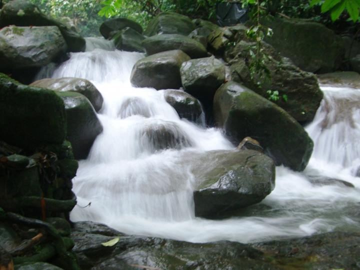
Just before reaching the Lolo campsite, you will come across a waterfall. It is a nice respite after a muddy walk. If you wish, you can take the opportunity to freshen up and splash about for a while at the waterfall before continuing your journey to the Lolo campsite. As you near the Lolo campsite, you will see the sad remains of a polluted trail with rubbish strewn here and there. Pushing that aside, we strived on to reach the Lolo campsite and after almost two hours, we finally stopped at the Lolo campsite. We usually start out at about 9 in the morning, and taking a leisurely hike, we would reach the campsite at slightly past 11 am or by noon the latest. Our favorite spot is a small waterfall/stream nearby where we will take a quick bite of our packed lunch while enjoying the sights and sounds.
From the Lolo campsite, we climbed on steadily for another two hours. The trail from Lolo to Tanah Pacat increases in difficulty and gets more “vertically challenging”. Using a hiking stick may help, but it all depends on the weather too. If it is raining or rained the day before, then the trail will become very muddy and slippery.
Soon after, we reached Tanah Pacat. Tanah Pacat is located right smack in the center of Gunung Nuang and can accommodate a number of campers who are staying for the night. The temperature at Gunung Nuang at nightfall can fall to a cold 15 degrees Celsius and very windy.
Moving on, it takes another two hours to reach the summit from the Tanah Pacat campsite. The higher we go, the steeper it gets. But finally, after many hours of sweat and tears, our efforts paid off – we have reached the peak!
What goes up must come down but I got to say, it is always easier to descend than to ascend. Even with the extra muddy trail on that day, with many of us slipping and sliding down more often than “walking”, the hike down feels relatively shorter. Overall, this would be a challenging hike for beginners. But for us, we enjoyed the refreshing break at the waterfall, the river crossing, and the weaving through the “obstacle course” of fallen trees and muddy terrain.
Getting There
From Kuala Lumpur, take the Cityliner bus no 838 near Puduraya, at Metrojaya. Take note that the first bus from KL starts at 6 am, and the last bus from KL is at 10 pm. The bus from Pangsoon is at 6:30 am and the last bus from Pangsoon is at 7:30 pm. When you arrive at the final bus stop, you will need to walk a distance of 1 to 2 kilometers to reach the forestry office.
Alternatively, you may drive there. There are lots of parking spaces.
 ThingsAsian